Private car, plane, and Helicopter.
Starting high in the Khumbu Valley, this route delivers raw mountain beauty without requiring a long walk back down. A flight out by helicopter cuts fatigue after reaching Everest Base Camp, making recovery quicker. Those short on days often choose this version to see everything - monasteries, stone trails, peaks - but leave less room for exhaustion. Instead of retracing steps through rocky paths, travelers rise above them, viewing glaciers from the air. Culture stays central: villages along the way share stories through prayer flags, teahouses, and daily life unchanged by altitude. Some find comfort knowing descent happens swiftly, avoiding risky downhill strain. Adventure remains intact, yet logistics bend slightly toward ease.
Starting in Kathmandu, the journey unfolds with a flight to Lukla, where the trail climbs slowly past Sherpa settlements beneath thick pine canopies inside Sagarmatha National Park. Villages such as Namche Bazaar and Tengboche mark key stops, each step rising carefully to help bodies adjust to thinner air. From these heights, Mount Everest - towering at 8,848 meters - emerges alongside Lhotse, Nuptse, and Ama Dablam, their sharp ridges cutting into open sky. Photographs come easily here, framed by sweeping panoramas that appear around nearly every bend.
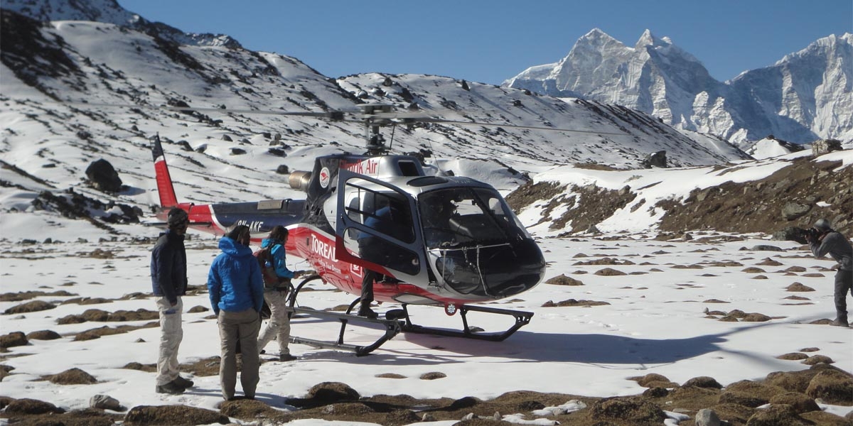
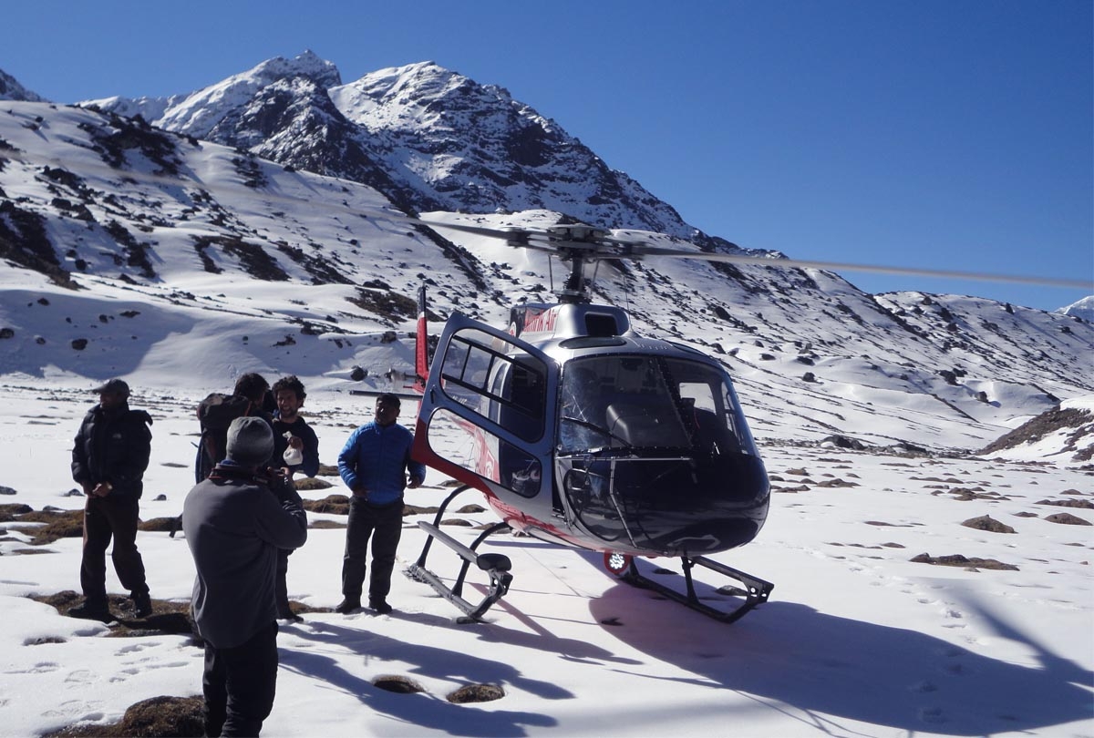
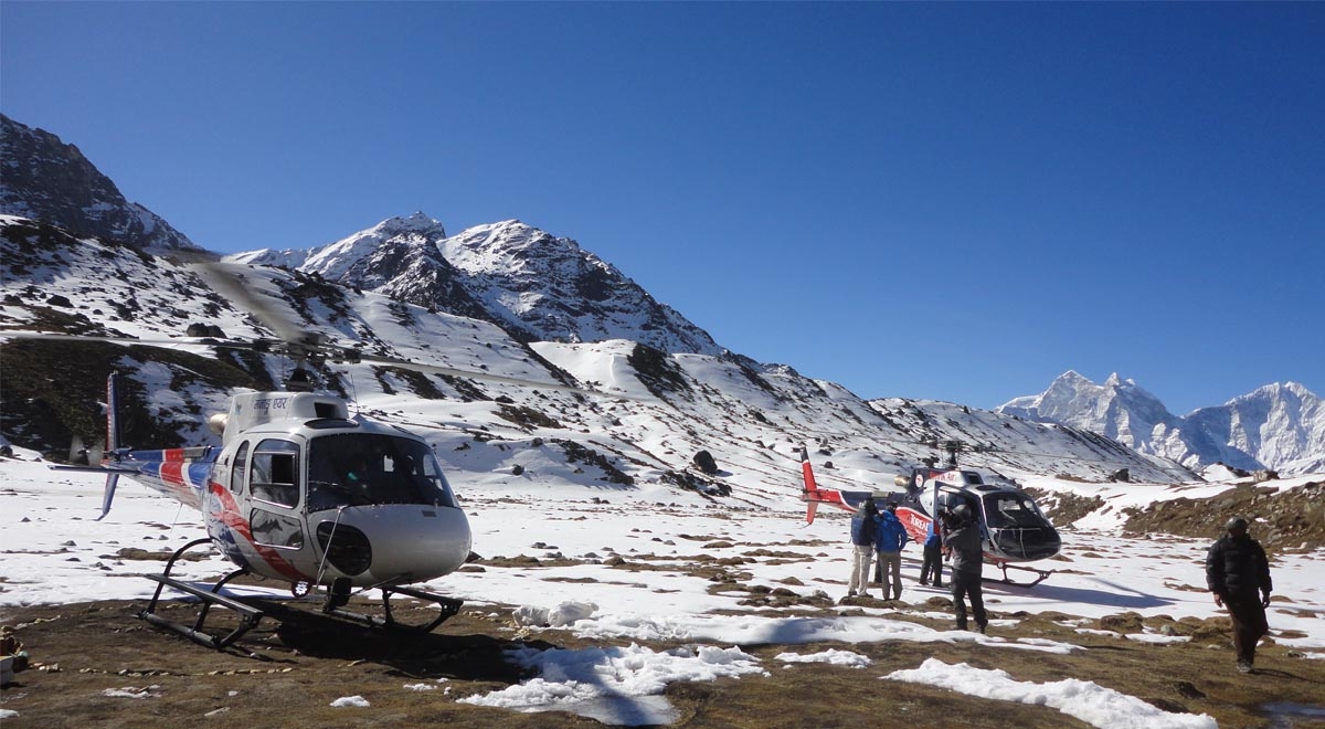
Rather than walking back after reaching Everest Base Camp, guests take a helicopter from EBC either to Lukla or straight to Kathmandu, opening up the journey to those wary of long descents or tight schedules. Soaring above rugged terrain, the flight unveils dramatic views - glacial rivers winding through rock, immense snow-covered summits, and steep ravines carved by ancient ice. Few chances exist like this one to see such raw mountain beauty from high above.
Starting among quiet trails, trekkers meet Sherpa life through ancient monasteries, rows of carved stone prayers, fluttering ritual banners. Instead of rushing upward, the path allows time - built-in rest periods help bodies adjust slowly to thin air. Alongside every ridge and valley, trained leaders offer steady support, sharing stories while watching weather, terrain, people. Adventure unfolds without hurry, shaped equally by mountain challenges and village moments. Each step blends physical effort with glimpses into ways long rooted here.
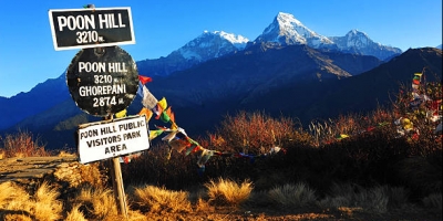
High above the valley floor sits Lukla, beginning of the journey, a compact settlement built along a steep slope. More than just an entry by air, it quietly reveals daily Sherpa life amid towering peaks. Soon after setting out, hikers meet sweeping green ridges, stones lined with colored flags, and constant murmur of the Dudh Koshi below. Altitude begins to settle into bodies here, step by slow step. Though basic, guesthouses in the town offer hot drinks, firm beds, warmth. First contact with mountain kindness happens between these wooden walls.
Nestled beside the Dudh Koshi River, Phakding is framed by pine woods and stepped fields growing crops. Though short - about eight kilometers - it takes four to five hours on foot from Lukla, giving time for adjustment. What stands out here is peace found near water, colorful prayer flags waving overhead, and pack animals moving supplies uphill. Instead of rushing forward, most pause in this quiet spot after arriving tired from earlier travel. Because it sits at a moderate elevation, the place eases people into mountain life without strain.
Perched high in the Khumbu region, Namche Bazaar pulses with energy as both marketplace and cultural hub. Rising along a rugged trail - roughly 11 kilometers taking five to six hours - the path unfolds sharp inclines paired with sweeping glimpses of Thamserku, then Kongde Ri. Once arrived, travelers encounter the rhythm of Sherpa life: spinning prayer wheels line stone paths, mani walls stretch between buildings, monks move quietly through monastery courtyards, stalls brim with regional goods. Altitude demands pause here; this stage supports vital adjustment before upward movement continues. Experiences unfold slowly - meals rooted in local tradition, conversations shaped by mountain living, horizons filled with snow-lit peaks.
Heading out from Namche, the path unwinds toward Tengboche - roughly ten kilometers that take most hikers four to five hours. Through stands of rhododendron and tall pines, the trail climbs steadily, opening into clearer air. Perched along a high ridge, Tengboche sits quietly, home to one of Khumbu’s earliest monasteries. From here, peaks like Ama Dablam, Everest, and Thamserku rise without obstruction, sharp against the sky. Inside, walls echo with chants; prayer wheels turn under steady hands. Visitors often linger, drawn by rhythm rather than sightseeing. Spiritual depth blends with mountain silence, creating moments that feel separate from time. Architecture rises simply, yet carries weight - not just stone but meaning. Though brief for many, this stop becomes memorable when stillness takes hold.
Few hours of walking below Tengboche lead first down, then upward again toward Dingboche - roughly twelve kilometers covered in five or six hours. Perched within a wide valley at great height, the settlement lies encircled by towering summits such as Lobuche, Chhukung, and Ama Dablam. Because altitude adaptation matters so much here, most travelers pause in Dingboche before pushing farther ahead. Though small, the place holds purpose: it prepares bodies for what comes after - Lobuche, then Base Camp. Stone houses dot the terrain, while rows of carved mantra stones line paths where yaks graze across open meadows. Life moves slow, shaped entirely by mountain rhythms.
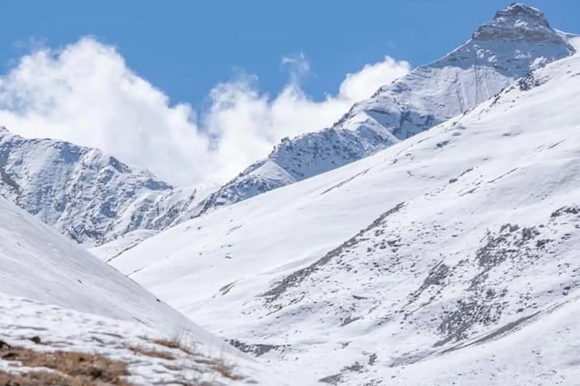
Upward from Dingboche, the path to Lobuche stretches roughly eight kilometers, taking five to six hours underfoot. Rugged stone fields and ancient glacial debris shape the route, step after step rising higher. This far-flung outpost stands just shy of Everest Base Camp, often serving as one final stand before the ice. Isolation settles in fast once trees vanish behind you. Peaks loom close now, jagged and unyielding, framing every turn. The air thins noticeably; each breath draws sharper than the last.
What was green valley floor gives way to open scree and wind-carved slopes. Few signs of ease remain - just rock, sky, and distance.
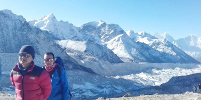
Perched near the Khumbu Glacier’s edge, Gorak Shep sits about 7 kilometers from Lobuche, reachable in roughly three to four hours. Reaching it feels like stepping into one of the highest inhabited spots along the route. Structures here - mostly temporary teahouses and basic lodgings - appear fragile against the rugged terrain. Climbers pause here before pushing toward Everest Base Camp or ascending Kala Patthar. Views stretch sharply across to Everest, Nuptse, and Pumori, clear and imposing under open skies. Though oxygen thins noticeably, making movement slow, people find strength in the stillness. Harsh conditions define daily life, yet travelers return again, drawn by necessity and scenery alike.
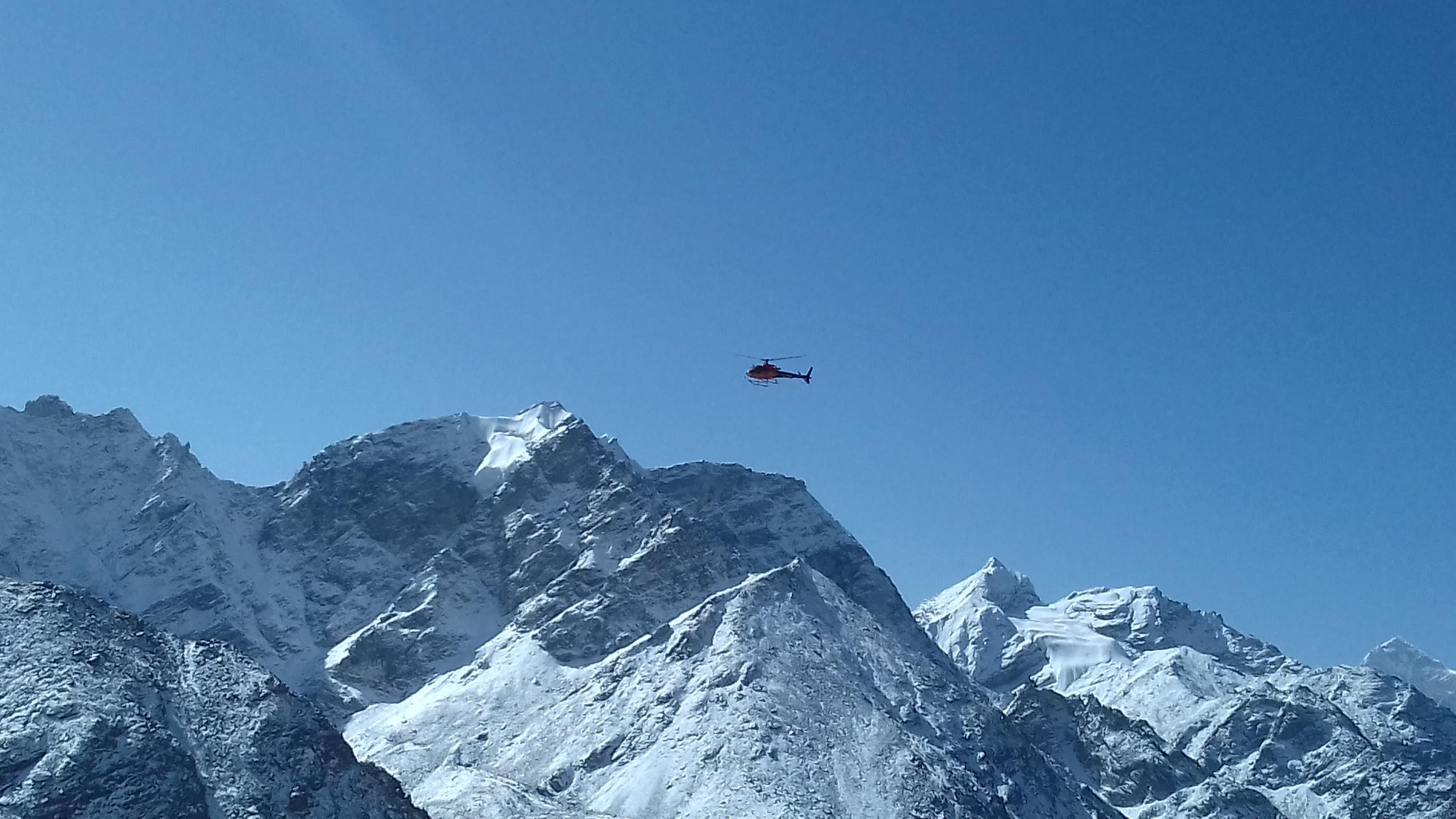
Moving toward Everest Base Camp - about 5 kilometers or two to three hours beyond Gorak Shep - means crossing rugged stretches of the Khumbu Glacier and its uneven moraines. Though distant, the towering Himalayan summits feel close once you reach camp, enclosing the area in silent grandeur. From here, eyes naturally drift upward to the Khumbu Icefall, that shifting river of ice where summit attempts take shape each season. This spot marks more than just an endpoint; it becomes real what once felt like imagination - the foot of Earth’s tallest peak under your boots. Instead of retracing steps on foot, a helicopter ride lifts travelers above frozen terrain, tracing paths over sharp ridges and snow-draped mountains toward Lukla or Kathmandu.
Expect a challenge - this path moves between moderate and tough effort, climbing past 5,500 meters at Kala Patthar while demanding extended walks, sharp uphill stretches, along with rocky, unpredictable ground underfoot. Physical readiness matters; strong heart health, previous time spent hiking, coupled with endurance make a difference here. Though flying back by air lessens strain when heading down, getting up still asks for solid groundwork ahead of time. Preparation counts: build strength through steady workouts, trail experience, plus consistent cardio drills starting no later than three months prior to departure.
High up - past 3,000 meters - altitude illness becomes possible. Stops built into the route, like in Namche Bazaar and Dingboche, help bodies adjust gradually. Headaches, queasiness, lightheadedness, tiredness: these signal trouble. Moving upward by day but resting lower at night supports adaptation; drinking lots of fluids matters too, while skipping alcohol helps prevent worsening effects. When serious signs show, speaking up to a guide right away is essential. If things go wrong fast, extra oxygen stands ready for urgent cases.
Warm days occur in low areas of the Khumbu, yet cold grips the peaks tightly. High elevations stay frozen while sunlight heats valley floors slightly. Blizzards strike without warning, along with gusting wind and shifting conditions overhead. Clear views appear most often before monsoon rains arrive, between March and May. After autumn storms pass, late September into November offers steady air and balanced warmth.
Along the path, tea houses offer simple stays - shared spaces with mattresses and blankets provided. Though restrooms are usually communal, they might include squat-style toilets or little running water. At certain lodges, hot showers come at a small extra cost. Power supply runs low, relying mostly on solar energy, which means charging devices can be difficult.
Meals throughout the journey come fully covered, offering both local Nepali fare and familiar Western options. To stay safe, treat every drop of drinking water - use the supplied purification tablets or a filter system. Rivers and mountain streams? Never drink straight from them; contamination risks remain high. For cleanliness on the move, pack hand sanitizer along with your usual toiletries - it makes a noticeable difference.
Though mobile reception reaches key settlements such as Namche, Tengboche, and Dingboche, it often fades without warning. When urgent contact is needed, satellite phones stand ready - set up ahead of time. Some guesthouses offer internet access; yet most charge a fee for the connection.
Headaches or stomach problems? Bring your own medicine just in case. When things go wrong, guides know how to respond - they’ve had training after all. For extreme cases, a helicopter might come through - depends on severity. Help exists, but preparation matters most.
Entering a monastery means leaving your shoes at the door. Prayer wheels remain off-limits unless someone says it is allowed. Modest clothing shows awareness of cultural norms. When capturing religious moments on camera, act with care. Engaging with Sherpa communities can lead to meaningful exchanges. Courtesy shapes every positive encounter
Despite porters handling bulky loads, trekkers ought to restrict luggage to between 12 and 15 kilograms. Carrying only necessities - water, snacks, a camera, extra clothes, and small personal things - is wise inside a daypack. Though help is available, lighter bags ease the journey.
Permits? Handled through your trekking company. Bring photocopies of your passport - TIMS card plus entry pass required. In Sagarmatha, going alone isn’t permitted; guides with official licensing must lead groups meeting set numbers.
| Day | Route / Place | Altitude (m / ft) | Trekking Distance / Time |
| 1 | Arrival in Kathmandu | 1,350 / 4,428 | – |
| 2 | Fly to Lukla & Trek to Phakding | 2,840 / 9,318 → 2,610 / 8,562 | 4–5 hrs (~8 km) |
| 3 | Phakding → Namche Bazaar | 2,610 → 3,440 / 8,562 → 11,286 | 5–6 hrs (~11 km) |
| 4 | Namche Bazaar → Everest Viewpoint & Back | 3,440 → 3,780 / 11,286 → 12,401 | 2 hrs (~4 km) |
| 5 | Namche Bazaar → Tengboche | 3,440 → 3,800 / 11,286 → 12,467 | 4–5 hrs (~10 km) |
| 6 | Tengboche → Dingboche | 3,800 → 4,410 / 12,467 → 14,468 | 4–5 hrs (~12 km) |
| 7 | Dingboche → Nagarjun Hill & Back | 4,410 → 5,000 / 14,468 → 16,404 | 2 hrs (~3 km) |
| 8 | Dingboche → Lobuche | 4,410 → 4,910 / 14,468 → 16,108 | 4–5 hrs (~8 km) |
| 9 | Lobuche → Gorak Shep → Everest Base Camp → Gorak Shep | 4,910 → 5,140 → 5,364 → 5,140 / 16,108 → 16,863 → 17,598 → 16,863 | 7–8 hrs (~15 km) |
| 10 | Gorak Shep → Kala Patthar → Helicopter to Kathmandu | 5,140 → 5,545 / 16,863 → 18,192 | 2 hrs (~3 km) + flight |
| 11 | Final Departure | 1,350 / 4,428 | – |
Note: If you want to trek only to Everest Base Camp, you can choose our 14-day Everest Base Camp Trek package.


Morning hike to the Everest Viewpoint for panoramic views of Everest, Lhotse, and Ama Dablam. Return to Namche Bazaar for rest, local shopping, and cultural exploration.
Trek across the Khumbu Glacier and rugged terrain to Gorak Shep. Continue to Everest Base Camp, absorbing the vast glacier views and the Khumbu Icefall. Return to Gorak Shep for overnight stay.
Early morning hike to Kala Patthar for the best panoramic sunrise view of Mount Everest and surrounding peaks. Descend to Gorak Shep and board a helicopter for a breathtaking aerial return to Kathmandu.
Transfer to the airport for your international flight home, concluding a once-in-a-lifetime Himalayan adventure.
The Itinerary can be customized to your need and the primary piece of gear for day hiking is about 15/20 Liter. you can keep your personal belongings in this bag.
The Everest Base Camp Trek with helicopter return through Adventure A One Treks was a once-in-a-lifetime experience. The trek to Everest Base Camp offered breathtaking views of snow-covered peaks, glaciers, and beautiful Sherpa villages along the way. Every day of the journey was filled with stunning Himalayan scenery and unforgettable moments. Reaching Everest Base Camp was a dream come true, and the helicopter return added a perfect touch of comfort and excitement to the adventure. The entire trip was well organized, and the team was professional, supportive, and always focused on safety and comfort. I highly recommend this package for anyone wanting a complete Everest experience with a luxury return option.
My Everest Base Camp Trek with helicopter return was one of the best adventures of my life. The trekking route to Everest Base Camp was filled with incredible mountain views, charming villages, and beautiful landscapes that made every step worth it. The journey was challenging but extremely rewarding. The helicopter flight back from base camp was a spectacular experience, offering aerial views of Everest, Lhotse, and the entire Khumbu region. Everything was perfectly managed, including accommodation, meals, permits, and logistics. The staff was helpful, experienced, and always ensured a smooth and enjoyable journey. I would definitely recommend Adventure A One Treks for this amazing Everest experience.
Starting at lower elevations, the trail climbs steadily into thin air past 5,500 meters - near Kala Patthar - with physical demand increasing throughout. Each stage lasts between four and eight hours, moving across jagged stone, shifting gravel, and sharp inclines that test balance and endurance. Although a helicopter ride shortens the downhill section, reducing strain on knees and joints, preparation remains essential. Strong heart and lung performance matter most; so does familiarity with multi-day hikes under variable conditions. Carrying gear for extended stretches demands stamina built through practice, not theory.
Essential means getting ready matters. Months before - two or three at minimum - aerobic activity helps, so does walking far while carrying weight. Climbing stairs builds stamina; strength work for legs supports joints under load. Instead of skipping gear early on, bring trekking poles along during practice runs. Proper footwear? Train in it. That way strain spreads evenly, risk drops when terrain gets rough.
Clear skies appear most often from March through May. Temperatures stay comfortable then, plus distant peaks stand out sharply against bright daylight. Late September into November offers similar conditions - dry air and steady light help vision stretch far across high ridges. When June arrives, downpours begin, soaking trails and weakening steep slopes until earth slides block paths. Visibility shrinks under thick clouds during those wet months. Winter follows with sharp cold; snow piles deeply from December onward, locking higher areas in ice for weeks.
At elevations beyond 3,000 meters, altitude sickness becomes a real possibility. Headaches, nausea, dizziness - these often appear alongside tiredness. To help adjustment, scheduled rest stops are built into the route: Namche Bazaar, then Dingboche, among others. Moving upward during the day but descending to sleep tends to reduce risks. Hydration plays a role too; drinking ample fluids supports the body’s response. Should discomfort intensify, speaking up to team leaders matters most. When situations turn serious, emergency oxygen stands ready for use.
True, rules apply in the Sagarmatha area - solo hikes above certain elevations aren’t allowed. A certified guide who speaks English will accompany each group, handling route decisions while watching for health risks and offering local insights along the way. Luggage moves separately, carried by porters assigned two trekkers apiece, which lightens daily strain significantly. This setup frees attention toward steady progress and adjusting to thinner air at height.
Simple rooms await along the trail, found inside teahouses and small mountain shelters where toilets and washing areas are shared. A bed comes ready with blanket and pillow, though comfort remains minimal by design. Before setting out and upon return, travelers stay in a modest three-star hotel located in Kathmandu. Showers with warm water may be used now and then, if a fee is paid on site. Power exists in fragments, mostly drawn from sunlight through solar panels mounted nearby
Breakfast, lunch, and dinner come covered throughout the journey, offering choices that range from plant-based dishes to those with meat. Expect familiar plates such as Dal Bhat, along with noodles, soup varieties, and pasta - each shaped by regional tastes and fresh supplies. Though main courses are provided, items like snacks or drinks including tea and sodas generally require separate payment.
Of course, having solid travel coverage that includes high-elevation hiking and emergency airlifts makes sense. While on the trail, sudden health issues may arise - this kind of policy helps manage those risks. Unexpected events happen; being covered brings a measure of safety should things go off track.
Sure, flying back by helicopter happens only when skilled pilots and local teams agree it’s safe, if skies allow. From above, Everest, Lhotse, and nearby summits unfold in striking detail. This method cuts travel time significantly while lowering physical strain following days at elevation. Conditions sometimes halt flights - such pauses are expected amid mountain climates.
Bringing proper clothing matters when climbing at elevation - insulated jackets, thermal base layers, and warm gloves make a difference. Trekking boots need to fit well; blisters slow progress fast. Hats help retain heat, especially overnight where temperatures drop sharply. Sleeping bags rated for cold conditions are non-negotiable on these routes. Walking poles offer balance on uneven ground, reducing strain over long stretches. Sunglasses must block full UV rays - the sun hits harder up there. Most companies supply a complete list ahead of time so nothing gets forgotten. Preparation often separates smooth trips from difficult ones.
Traveling alone is allowed, yet one condition applies: each person needs to be part of a team that has at least three members, along with an officially certified guide. Arranging such groups falls within the services offered by the company for those arriving on their own.
Entering a monastery? Leave your shoes outside. Prayer wheels should be left alone unless part of worship. Modest clothing shows awareness of cultural norms. Photographs of individuals or rituals require consent - always check first. Though Sherpas welcome visitors with openness, courteous behavior keeps relationships balanced. How one acts matters just as much as where one goes.
Warm days in the lower valleys can shift quickly to biting cold as elevation increases. Higher up, mornings and nights feel sharply colder, often near freezing. Sudden storms sweep through the Khumbu area, bringing snow even in clear seasons. Wind rises without warning, catching unprepared travelers off guard. Protection comes from layering clothes, not relying on a single heavy jacket. Waterproof outer layers make a difference when skies turn gray mid-hike. Conditions change fast - what starts mild ends harsh by dusk.
When Lukra flights get delayed - which happens often because of mountain weather - extra nights and food might be needed, though these aren’t part of the base cost. Logistics fall under guide responsibility once changes occur. Safety takes priority, no matter what.